Are $5,000 akiya houses a hidden gem in real estate, or are they more myth than reality?
Japan’s ultra-cheap akiya (空き家) houses have become something of an internet sensation, with headlines promising dream homes for as little as…

Japan’s ultra-cheap akiya (空き家) houses have become something of an internet sensation, with headlines promising dream homes for as little as…
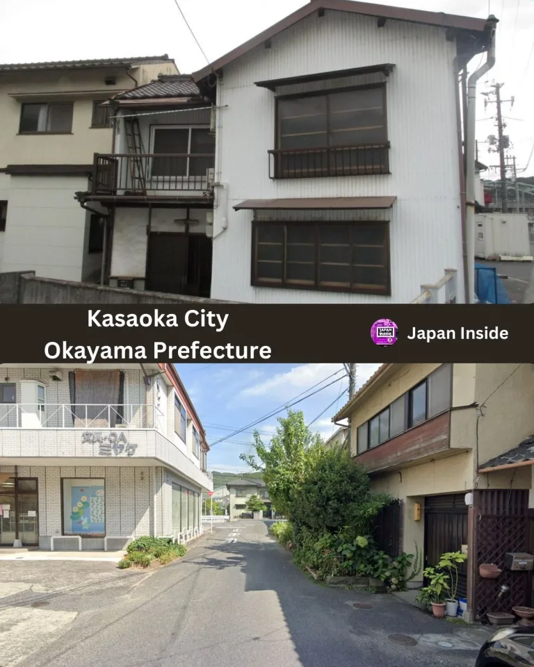
This affordable Japanese home is listed at just 2,000,000 yen ($12,903 USD). Located in the heart of Kasaoka City, Okayama Prefecture,…
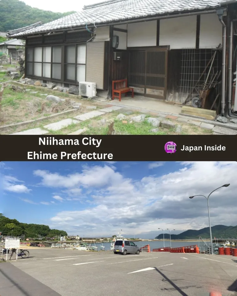
This longed-for island life is realized on the only island ‘Oshima’ in Niihama, listed at just 2,700,000 yen ($17,419 USD). With…
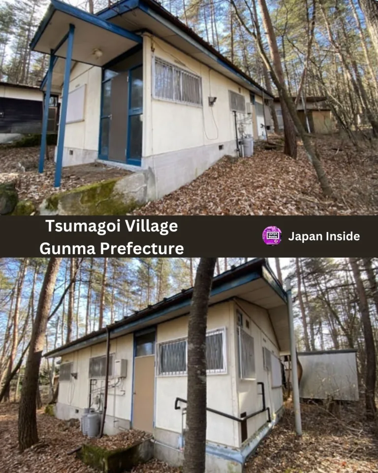
This charming Japanese home is listed at just 2,800,000 yen ($18,065 USD). Located in the peaceful Tsumagoi Village, Azuma District, Gunma…
This spacious two-story wooden house is listed at 25,000,000 yen ($161,290 USD). Located next to Kunimi Junior High School in Nagahama,…
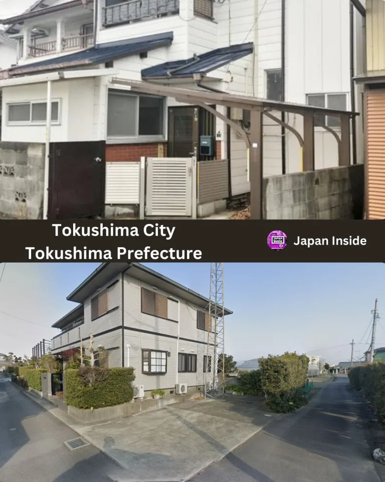
This traditional Japanese house is listed at just 3.3 million yen (21,290 USD). Located in Tokushima City, it offers a glimpse…
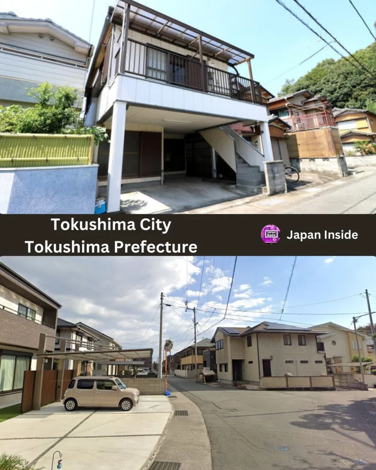
This traditional Japanese house is listed at just 6.8 million yen (43,871 USD). Located in Tokushima City, it offers a blend…
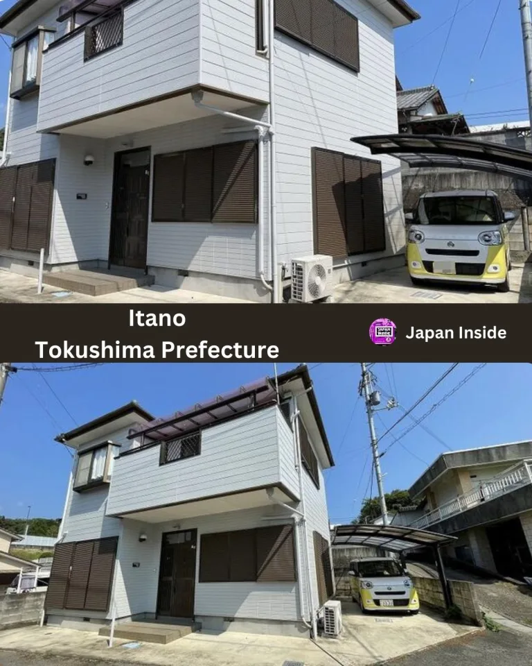
This traditional Japanese house is listed at just 8,980,000 yen (57,935 USD). Located in Itano, Tokushima Prefecture, this property offers a…
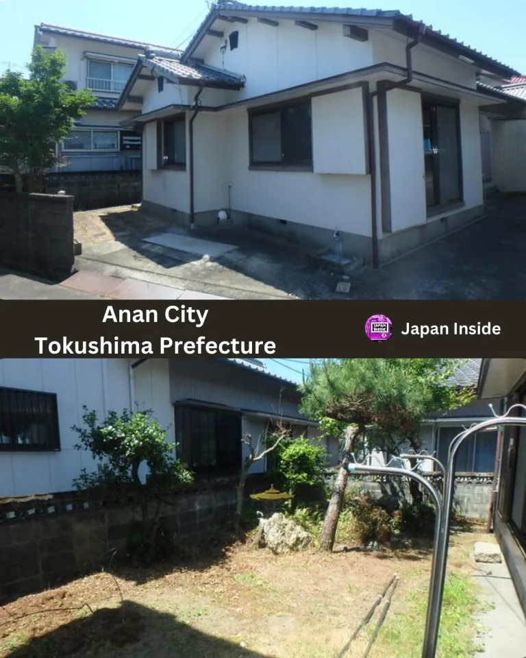
This traditional Japanese house is listed at just 4,000,000 yen (25,800 USD). Located in Anan City, Tokushima Prefecture, this affordable property…
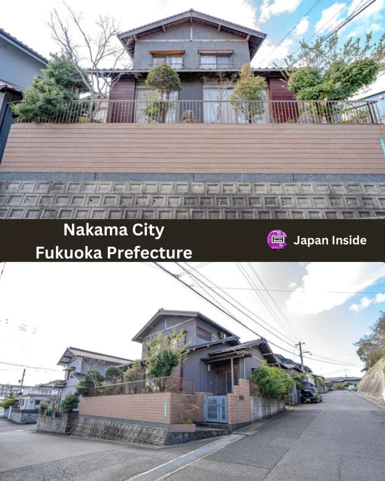
This traditional Japanese house is listed at just 4,900,000 yen (31,613 USD). Located in Nakama City, Fukuoka Prefecture, this property offers…
End of content
End of content